
Mt. Solmar Hike in Cabo: The Dog Hike Everyone Talks About!
If you’ve spent any time on Cabo Facebook groups or chatting with repeat Cabo visitors at a beach bar, chances are you’ve heard whispers about that hike.
The unique one with rescue dogs. The one locals rave about. The one that’s free, rugged, sweaty, with OMG views – and oddly heart-warming all at once.
We love hiking and have done other hikes in Cabo, like the Fox Canyon hike. But we’d never done this one. Now that we have, we get the hype.
The Mt. Solmar hike isn’t polished or touristy. There are no trail signs, no railings, no gift shop at the top.
Instead, there’s desert scrub, serious rock scrambling, jaw-dropping views and a pack of exuberant rescue dogs charging happily up the mountain beside you. It’s equal parts workout, adventure and Cabo “only-here” experience.
This is our no-filter guide to hiking Mount Solmar with dogs – what it’s really like, what surprised us and what you should know before lacing up your running shoes or hikers.
Featured reader comment/question
🐕 Mini-guide to the Mt. Solmar dog hike
Don’t be fooled. This isn’t a walk in the park. You’ll get sweaty, dirty and use your hands to scramble up boulders near the top. But we dare you not to be grinning by the time it’s over!
📍 Meeting information
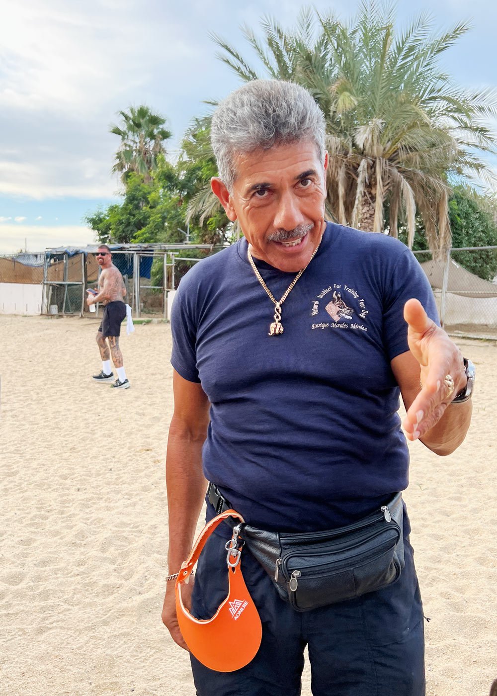
- Who leads the hike? It’s guided by Enrique Morales, owner of the Dog Training Camp.
- When? It’s offered daily from Sunday to Friday at 8:00 am (no hike on Saturdays). In hotter months, the start time shifts earlier to 6:00 am. (Enrique sometimes leads full moon and other special hikes too.)
- Where? Meet on Boulevard Paseo de la Marina at the west end of marina. Search The Hike With Dogs or Dog Training Camp on Google Maps.
- Cost? Its’s free, but tips are highly encouraged to support the dogs who accompany you on the trail.
🥾 Mt. Solmar trail stats
- How high is Mt. Solmar? Mount Solmar rises roughly 440 to 460 feet (134 to 140 meters) above sea level.
- Difficulty? The hike is moderate to challenging due to steep inclines and rock scrambling. Proper shoes are essential.
- How long does it take? The round-trip hike takes about 2 hours, including time to soak up the views at the top.
👨👩👧👦 Who can do this hike?
It’s suitable for a wide range of ages. We saw kids as young as six and a few adults well into their 70s. Fitness matters more than age. If you’re reasonably active, not afraid of heights and comfortable using your hands for balance (and a bit of rock climbing), you’ll be fine.
Contact
- Online – See Enrique’s Ascenso al Cerro del Vigia Facebook site for videos of the hike and more info.
- Phone – Call +52 (624) 122-1316.
➡️ Also see the comments/questions at the end of this article.
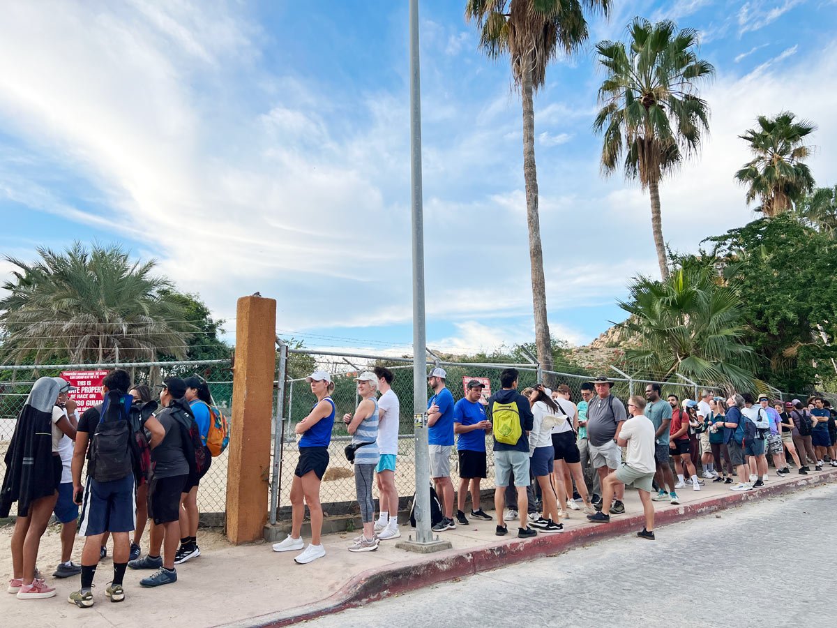
Where it all begins – a locked gate and a line of strangers
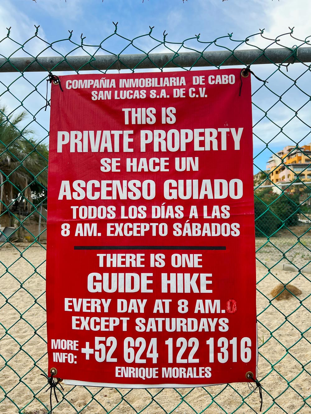
You meet on a regular street (at the Dog Training Camp on Boulevard Paseo de la Marina), near the Cabo San Lucas Marina.
There’s no grand entrance, no fancy signage – just a group of people slowly lining up outside a private gated property, water bottles in hand, trading sleepy just-woke-up smiles. (We took an Uber to get there.)
Must-know: The property is private, so you can’t do this Cabo hike on your own – only as a guided hike.
The gates are opened right on time, then locked again
We did this hike in late December. Just as we’d read, the gate was opened precisely at 8:00 am. (In summer, the start time is earlier at 6:00 am.)
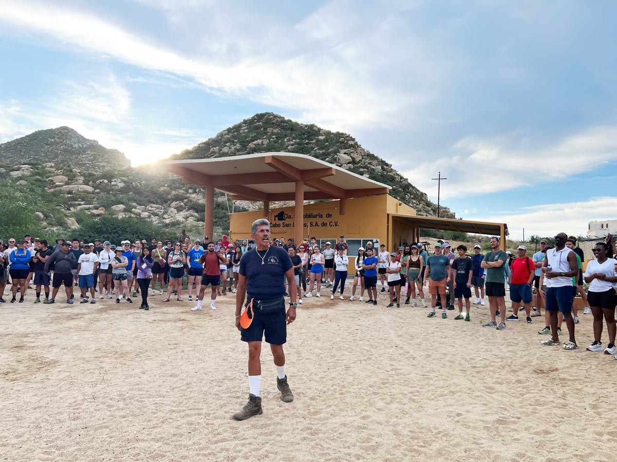
Once inside, everyone gathered in a loose circle around the dusty yard. Enrique Morales – the hike’s muscled organizer and owner of a dog training camp – welcomed us all and laid down the ground rules.
Some are practical:
- Stay on the trail.
- Watch your footing.
- Listen to the guides.
Others caught our attention fast.
Enrique explained that the property is monitored by cameras. If you wave both arms overhead, that’s interpreted as a distress signal — and medical help will be sent to you. Translation: Don’t wave for photos or videos.
Tip: Don’t be late, as the gates are locked again about 15 minutes after the start time.
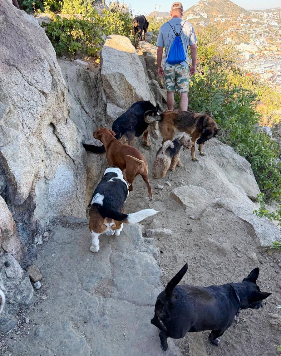
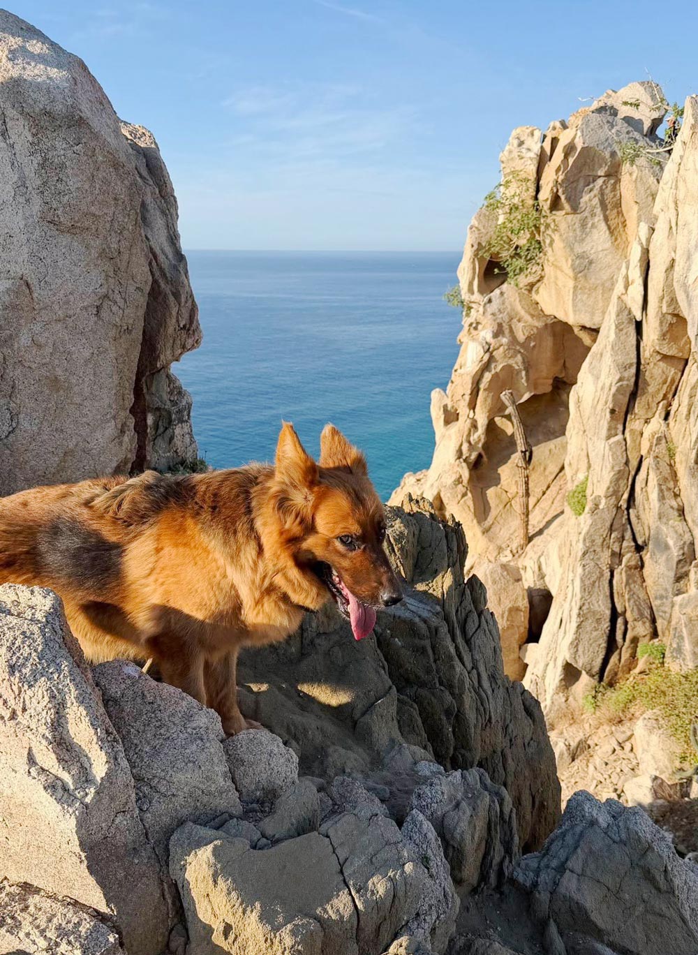
Releasing the dogs
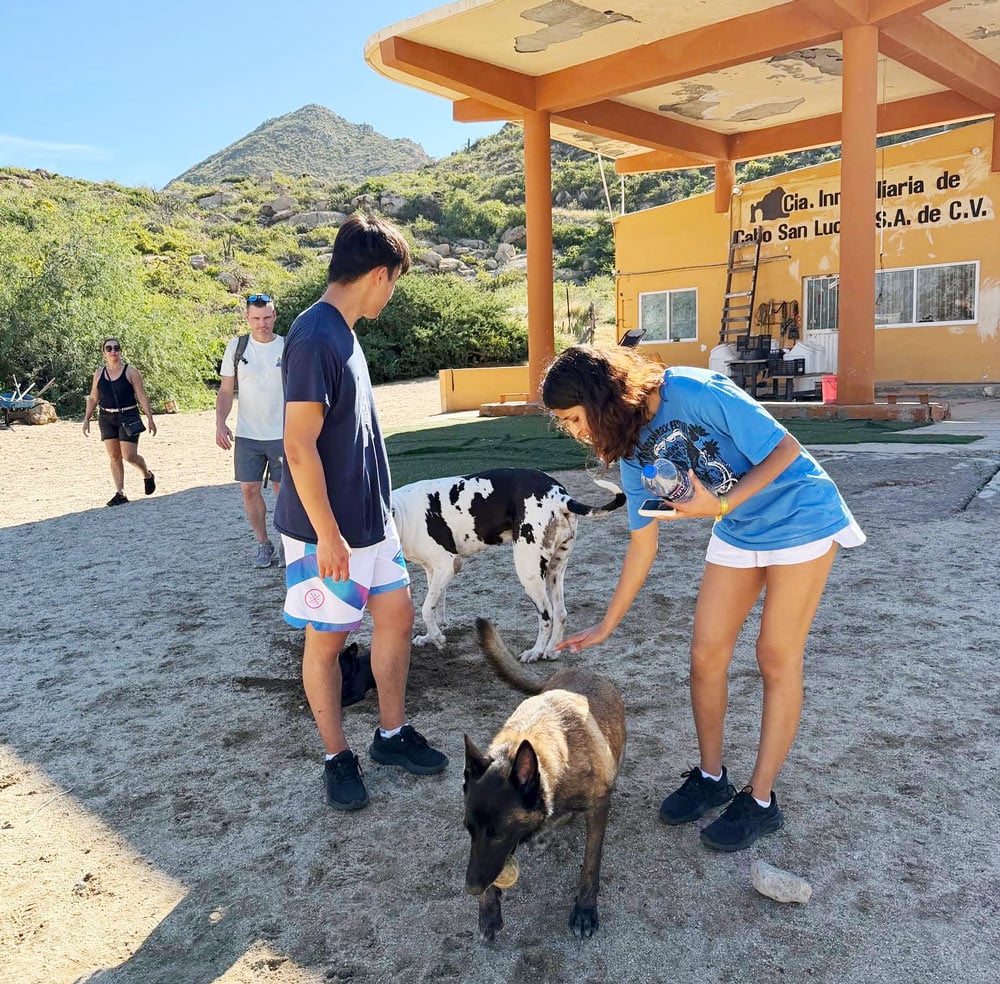
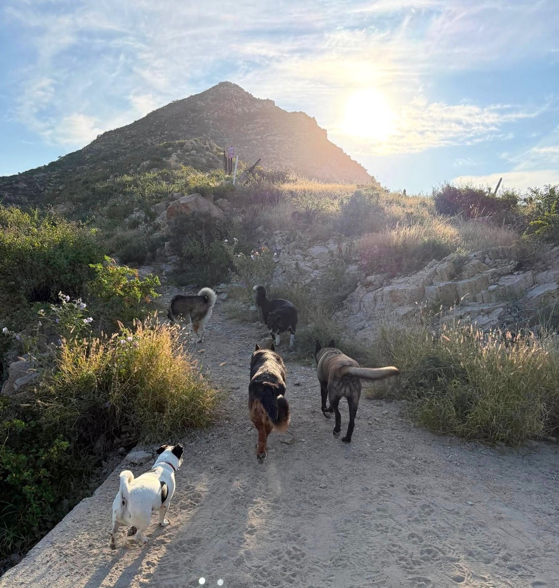
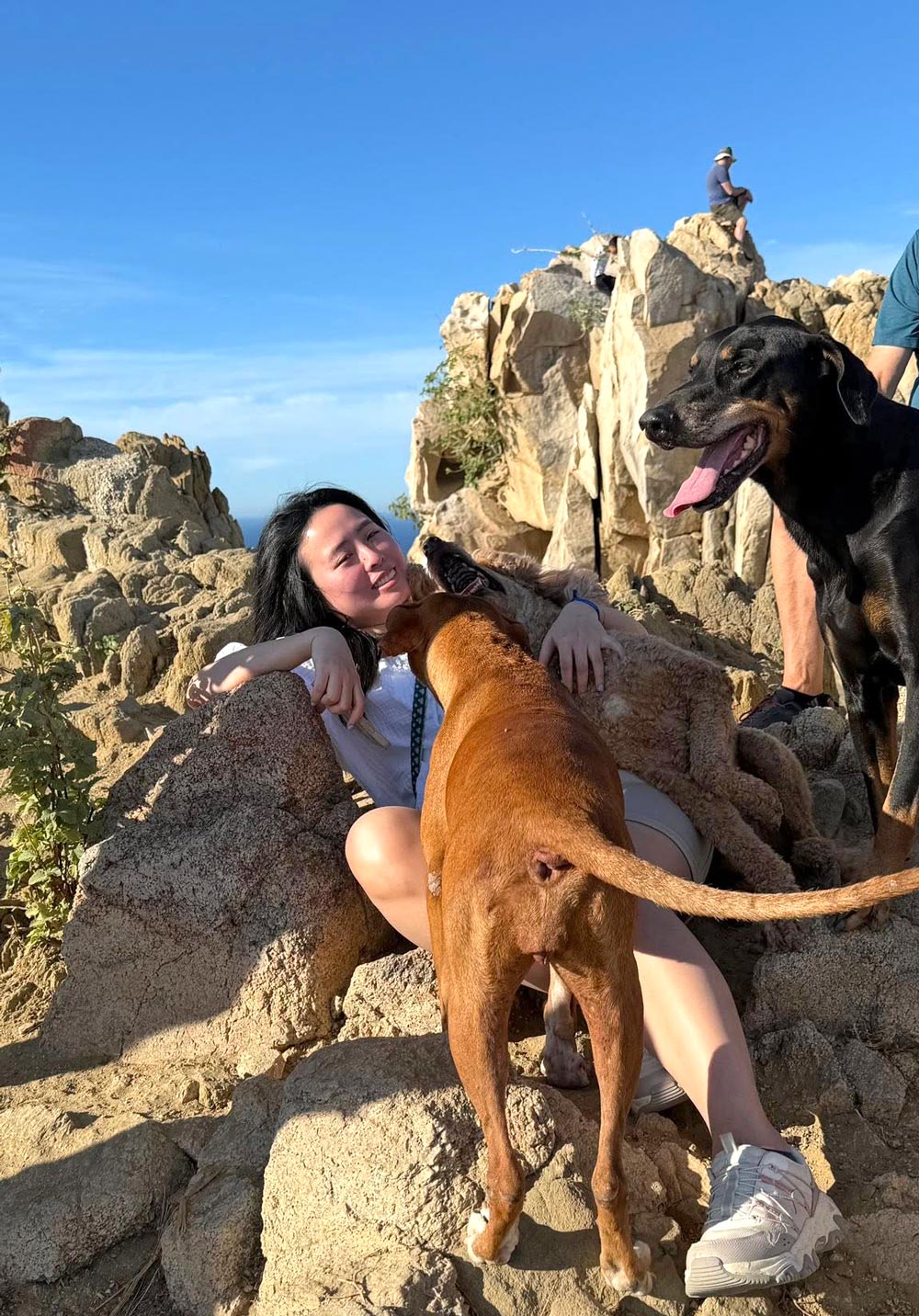
One by one, Enrique opened the dog enclosures – and out bounded about 15 large rescue dogs, barking loudly and bursting with energy.
Some hikers, including us, were a little nervous at first, instinctively backing away so the dogs wouldn’t trip us up.
But we quickly noticed they were completely under Enrique’s control. When he barked commands back at them, they listened.
Group size
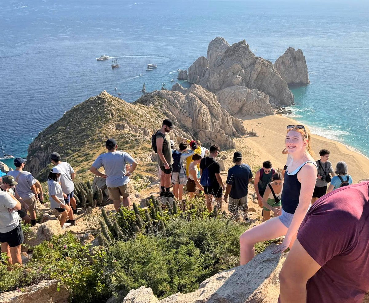
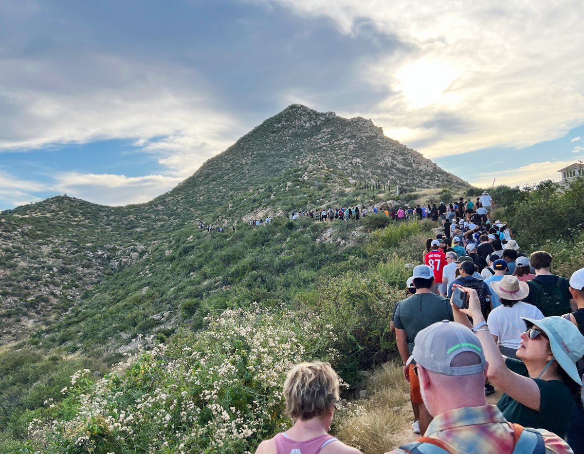
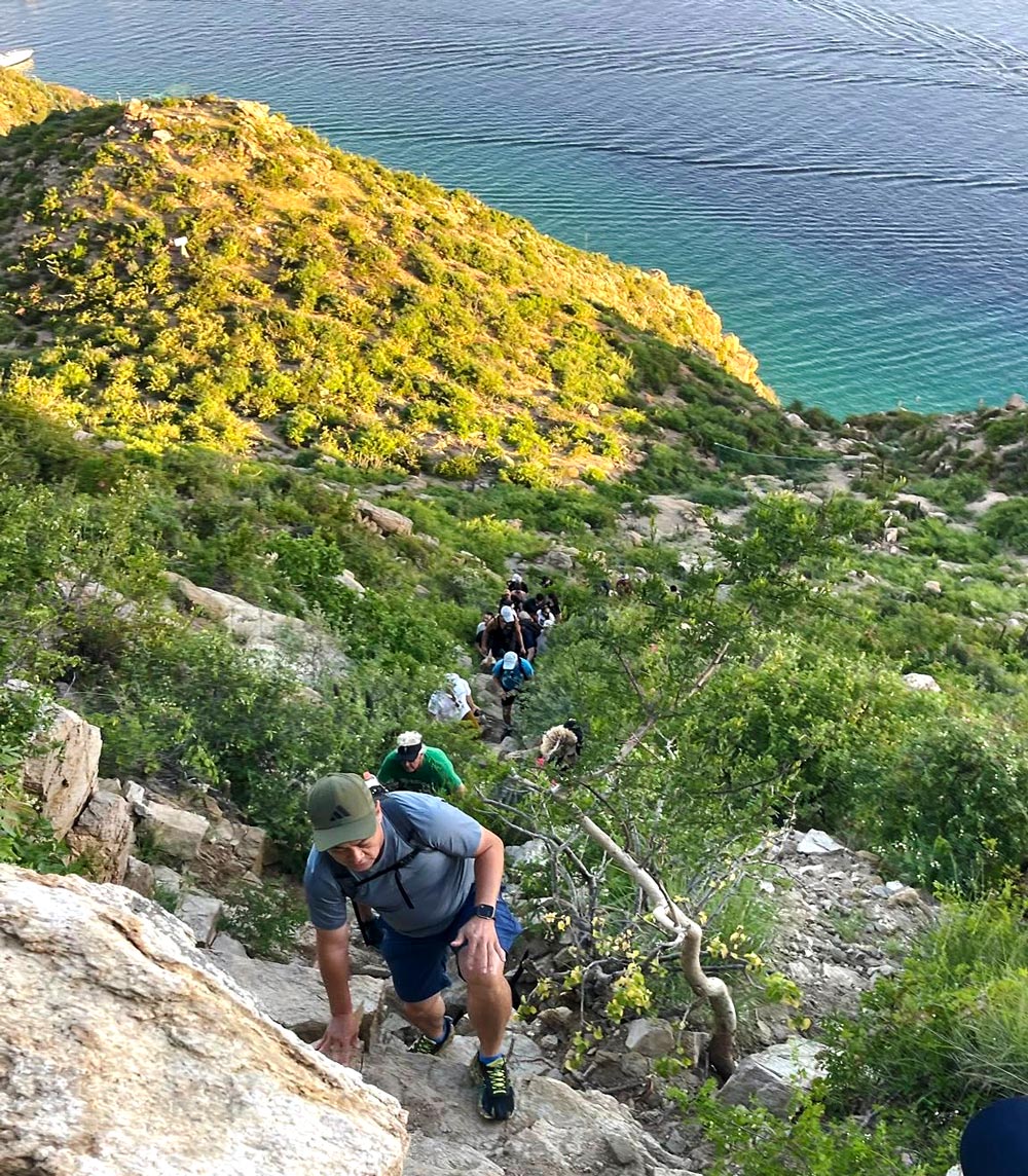
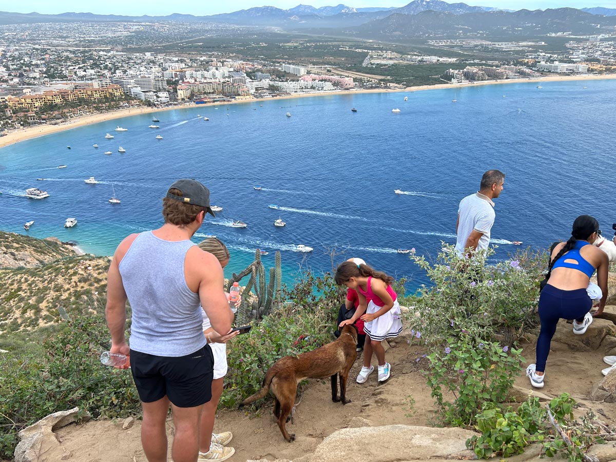
We expected maybe 20 to 40 other hikers. Wow, were we wrong.
We were amazed to see about 350 people show up for the hike. And it wasn’t just visitors – there were equally as many locals. (Enrique later told us the largest group he’s ever led was 550 hikers!)
The timing likely played a big role. We were hiking during peak holiday season, between Christmas and New Year’s, when Cabo is at its busiest.
Still, this hike wasn’t always so well known. Years ago, it was more of a local secret. But word has clearly gotten out, and it’s now one of Cabo’s most popular “in-the-know” experiences.
Enrique likely anticipated our group would be large – bigger than normal, he said – and he had another leader with him. That meant that after the initial stretch of trail, hikers had a choice of two different routes up:
- The original “easier” trail – Led by Enrique
- A harder, more vertical route – Climbing a neighboring peak with the second guide, then traversing a ridge up top to meet up at the Mt. Solmar summit
We stuck with the original trail – and it was challenging enough.
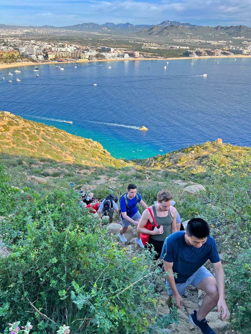
The climb up – sneakily tough
The trail, step by step
The hike up Mt. Solmar takes about 45 minutes to an hour, depending on pace and crowd size. It took us roughly an hour to reach the top.
It starts off gently as a wide sandy path, with cactus and desert scrub on either side. Gently rolling hillocks lull you into thinking, “This isn’t so bad.”
Then it changes. The trail narrows…
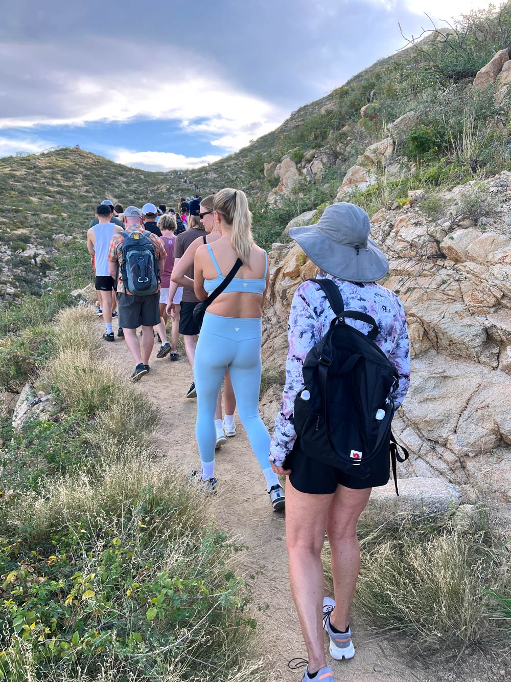
Rocks appear on the “path.” Elevation increases…
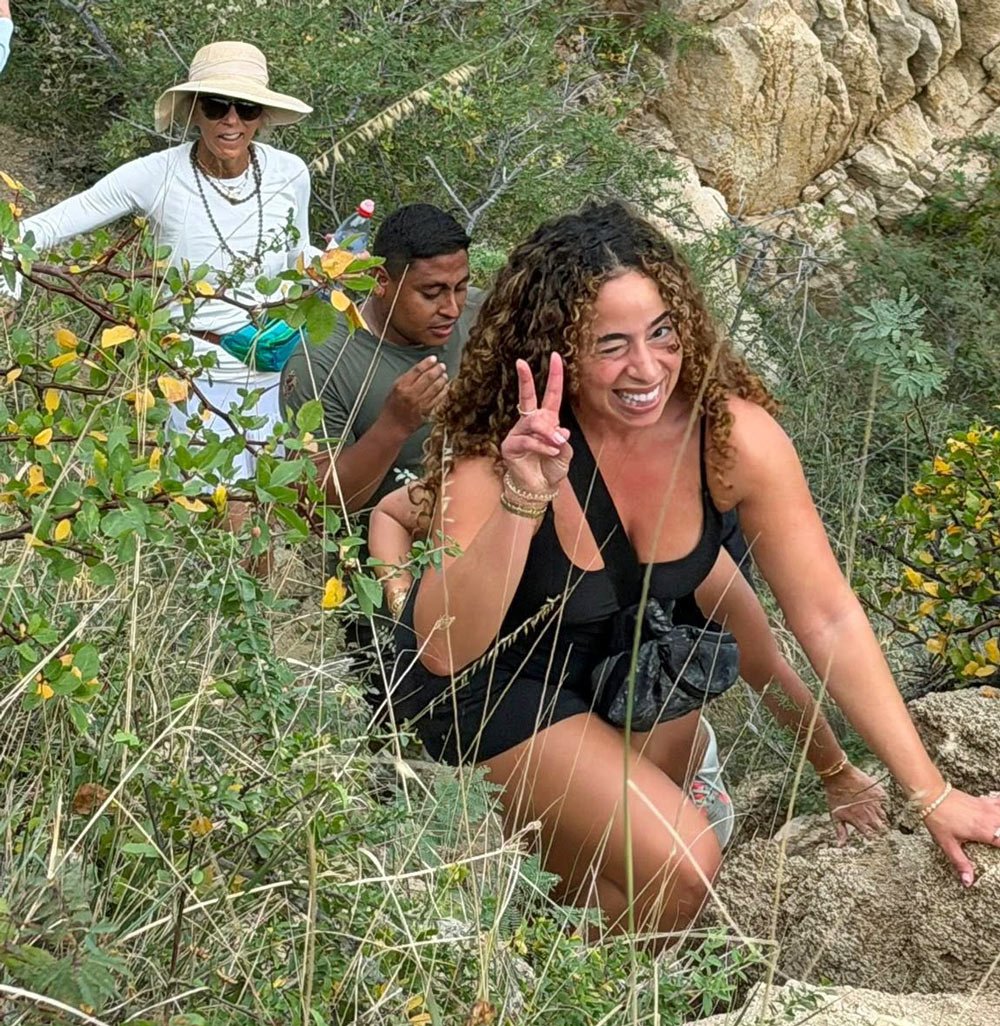
Suddenly, we were stepping over loose stones, dodging thorny cacti and pulling ourselves up rocky sections using our hands (being careful not to grab a cactus by mistake).
At least half of the original trail is uphill, and much of it requires real hand-assisted scrambling. We used our hands a lot!
One of the nicest surprises, though, was the shade.
Because the hike starts early and climbs the shady side of the mountain, we were protected from the sun for most of the ascent. The sun only crested the top and hit us on the way down, starting around 9:00 am.
(It was a relief to tuck away our hats and sunglasses – and not worry about them while wiping sweat from our faces.)
Tip: Be mindful where you place your hands. Some of those innocent-looking “cucumber” cacti resemble pillar-shaped rocks – but they’re absolutely not your friend.
Desert details you’ll notice (if you’re not too busy breathing)
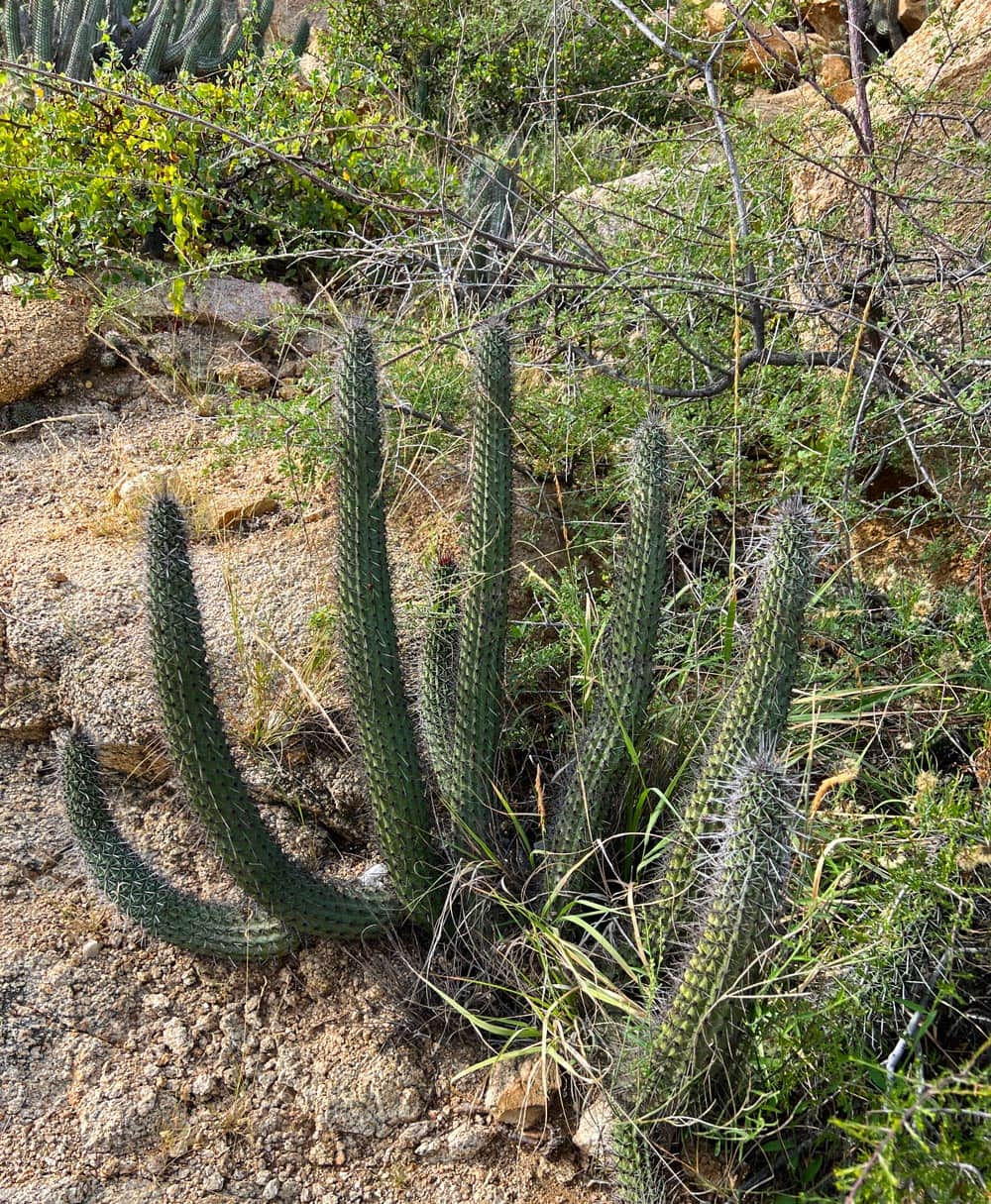
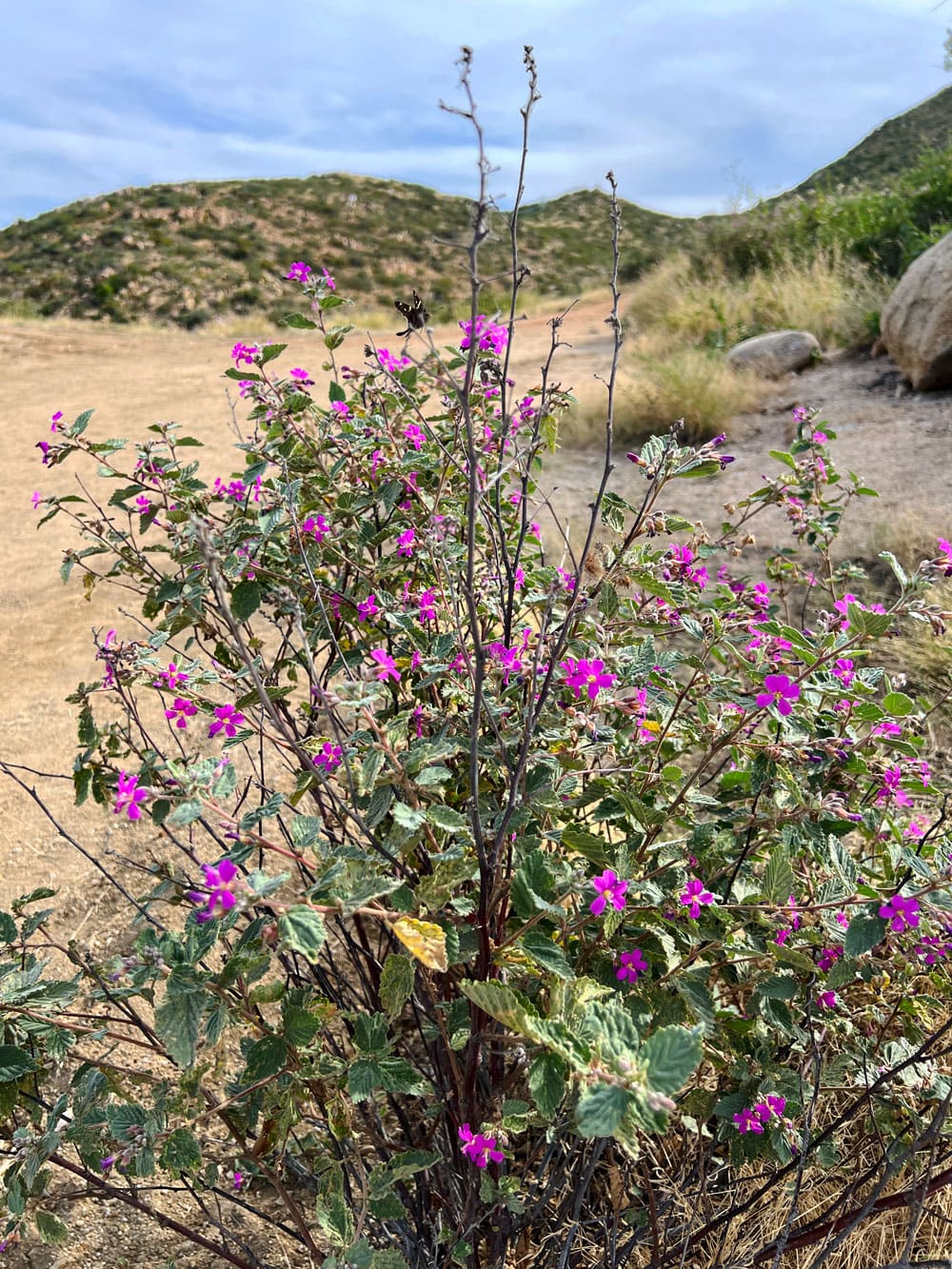
One thing that really struck us was how green everything looked.
Cabo’s desert isn’t always this lush, but heavy rains earlier in the fall – and again just weeks before our hike – had transformed the landscape.
Cacti, bushes and even flowers were vibrant and alive, a reminder that this desert has moods.
Tip: Take it slow if you need to. If you’re afraid of holding people up, let others pass so you’re at the back of the conga line.
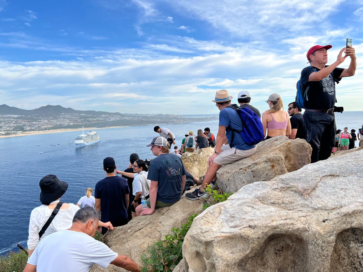
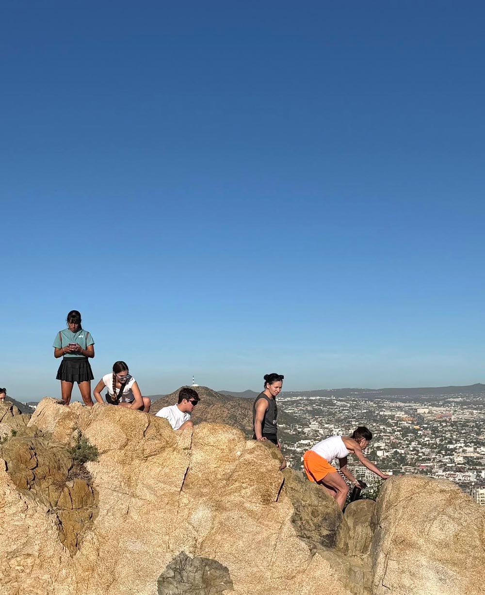
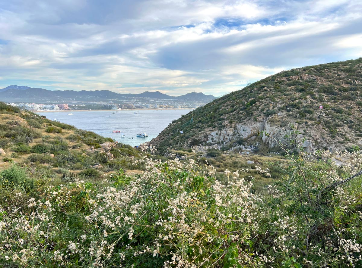
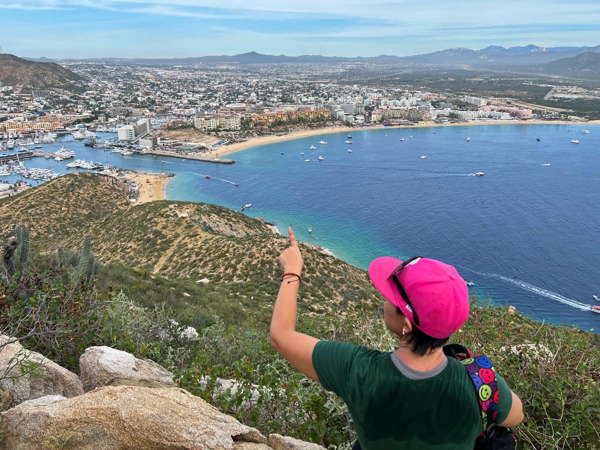
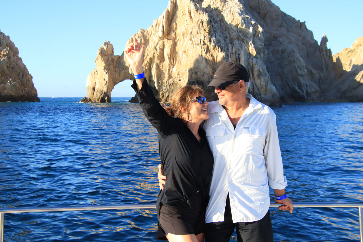
The view at the top – Cabo from every angle!
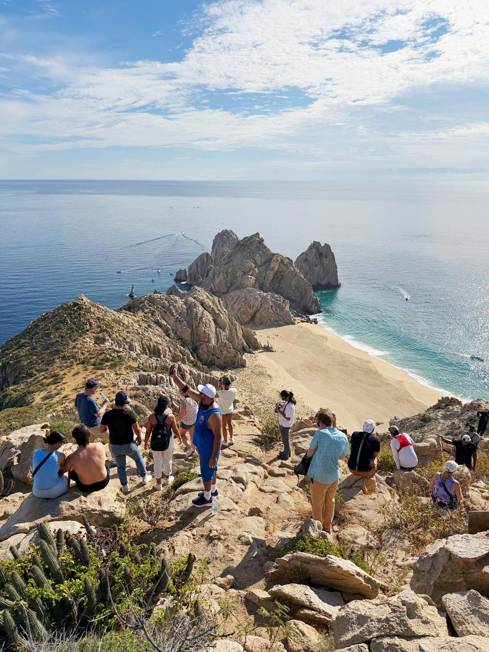
Reaching the top feels like stepping onto a natural observation deck. The views are completely worth every scraped knee and dusty palm.
To the east, you look out over the Sea of Cortez, with the marina spread out to the left. The white boats look like tiny toy models from this height.
You can see Medano Beach in the distance, Cannery Beach at the marina entrance and, directly below, water taxis zipping back and forth toward Land’s End and Lover’s Beach. Pelicans and frigate birds circle overhead, and when we were there, a cruise ship was anchored out in the bay.
Turn the other way, and the scene changes completely.
Now you’re facing the Pacific Ocean, stretching endlessly in deep, powerful shades of blue.
If you look straight down, you see sheer granite columns dropping toward the sea, dotted with stubborn cactus clinging to impossible ledges. It’s stunning – and slightly terrifying if heights aren’t your thing.
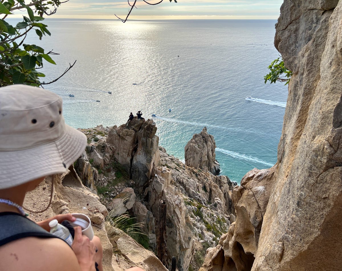
Some hikers continued farther along the top of the mountain ridge toward the tip of Land’s End, where Enrique says the views are even better. We stopped short, though. The terrain gets trickier beyond this point, and we were happy with our perch.
And while everyone was drinking in the views and catching their breath, the dogs were having the time of their lives.
A few bounced around the top of the trail like this was the best outing ever – which, for them, it probably was. By then, they’d burned off enough energy to slow down and happily accept a few well-earned pats.
The real challenge? The way down
If the climb up is about burning thighs, the descent is a test of nerve.
Somehow, going down feels steeper. It’s definitely slower and more technical.
More than once, we turned around and climbed down backward, ladder-style. Other times, we just scooted down on our butts over pebbly rock.
By the time we reached the bottom, we were covered in dust and sporting a few scratches on our hands. (But we had no holes in our shorts!)
And pssst! We hate to admit this. We were the very last people down! Our excuse – and we’re sticking to it – is that we took our time enjoying the scenery.
Being last had its perks though. It gave us a chance to chat one-on-one with Enrique afterward.
When asked, he told us that rattlesnakes do live on the Pacific side of the mountain – but hikers don’t encounter them, as the snakes prefer the sun-exposed side, not the shady side used for the hike. Good to know…
After saying goodbye, we slipped a few peso notes into the tip box near the exit, then headed off – a little wobbly but very happy.
Practical tips for the hike
- Bring a big water bottle – It’s hot and you’ll get thirsty.
- Wear a backpack – Stash your water bottle inside, so you can keep your hands free for scrambling.
- Carry a sun hat and sunglasses – You’ll need them on the way down.
- Good shoes are non-negotiable – Think running shoes or even better, trail or hiking shoes.
- Expect to get dirty – This isn’t the hike for white shorts!
- Leave valuables behind – No one wears bling on this trail.
- Bring small bills – You’ll want to tip at the end to help support the rescue dogs.
➡️ More information: See Ascenso al Cerro del Vigia
More fun things to do in Cabo

Our favorite resources for planning a trip to Cabo
Resorts: Booking.com is great for scoring a “wow” hotel in Cabo – or at least a decent one. (We especially like their flexible cancellation policy!) Expedia is also worth checking for discounted hotel rates in Cabo.
Vacation homes, condos and rentals: We prefer and use Vrbo (Vacation Rentals by Owner).
Tours: For the best local guided tours in Cabo, see Viator and GetYourGuide.
Car rental: Renting a car in Los Cabos is one of the best ways to explore. Discover Cars searches car rental companies so you get the best rates.
Travel insurance: SafetyWing is designed for frequent travelers, long-term adventurers and digital nomads. It covers medical expenses, lost checked luggage, trip interruption and more. We also have and recommend Medjet for global air medical transportation and travel security.
Need more help?
- See our Start here page. It lists everything we’ve written on Cabo.
- Also check our ultimate Cabo travel guide and our article on Planning your Cabo vacation: What you should know.
Pssst! If you make a booking or purchase through our site, we may earn a small commission (at no cost to you). Thanks!
About the authors
Thanks for such a detailed recap. I’ve been curious about and wanting to do this hike for years!
Just one question: You mention needing your hands to climb up and a spot at the top where we shouldn’t look down if heights aren’t our thing.
I’m wondering if you’re ever walking along a narrow ridge? I’d love to do this with my 8 year-old-son but I don’t want to risk anyone falling off a ledge. Is that a valid concern or is the trail always wide enough to feel safe? Thank you!
First, know that a LOT of people have done this hike (from young to old), and we’re not aware of any serious injuries or accidents (so far).
That said, you have to be very mindful — of yourself and other people. The top is like a narrow rocky ridge, and a person could fall if they were accidentally bumped while standing up or if they tripped. When we reached the top, we used our hands, crouching down to move around. If we stood up, we’d lean against another rock so we wouldn’t lose our balance.
We saw other children there, and because they’re so agile (and lower to the ground), they seemed to have no trouble.
Definitely insist on safety with your son — and not to venture too far away from you. And you should be fine. You don’t have to scramble along to the edge of the ridge to get great views.
Hang back and be the last (nothing wrong with that!), find your stable spot at the top, let other people move around you, and don’t feel pressured to move if you’re not comfortable.
It’s such a beautiful hike, we’d hate for safety concerns to prevent you from doing it. You just have to know there is some risk, and you have to know your limits.
Hope this helps!